 Floating Moab Daily
Colorado River
Overview
|
Thu 74 | 54 |
Fri 71 | 50 |
Sat 63 | 46 |
Sun 69 | 44 |
Mon 78 | 45 |
| View Full Weather Details | ||||
|
Thu 74 | 54 |
Fri 71 | 50 |
Sat 63 | 46 |
Sun 69 | 44 |
Mon 78 | 45 |
| View Full Weather Details | ||||
Castleton Tower - Center Right
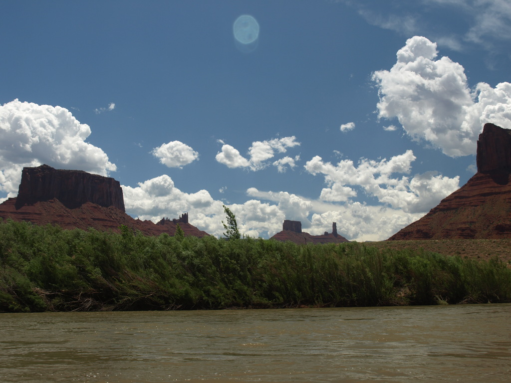
Likely the most floated stretch of river in Utah, the Moab Daily is a class III section of the Colorado River near Moab. The 14-mile section is extremely popular with families, locals, and guiding companies. Although class III, this is a float that is beginner friendly at flows below about 10,000 cfs. Above about 10K cfs, it is solid class III. The rapids, 6 in the 14 miles, with several smaller rifles and wave sections, are all separated by long stretches of flat water that gives beginners a chance to re-group after each short rapids section.
Hardcore river rafters may find this section boring. If you are looking for extreme river rafting, look elsewhere. If you are looking for a casual day out, with exquisite scenery, this is a good choice. It is busy on weekends in the summer, but both the put-in and takeout offer ample parking. Although a shuttle is helpful, hitchhiking is also a good option.
River scene near Hittle Botom
Getting There
Take Out
North out of Moab, just before the bridge over the Colorado River, turn right onto UT-128. Follow the highway 9.9 miles to the obvious, and well signed, Take Out beach parking area on the left.
Put-in
Continue on UT-128 an additional 12.5 miles (22.5 miles total from the turn off onto UT-128 north of Moab) to the signed Hittle Bottom put-in.
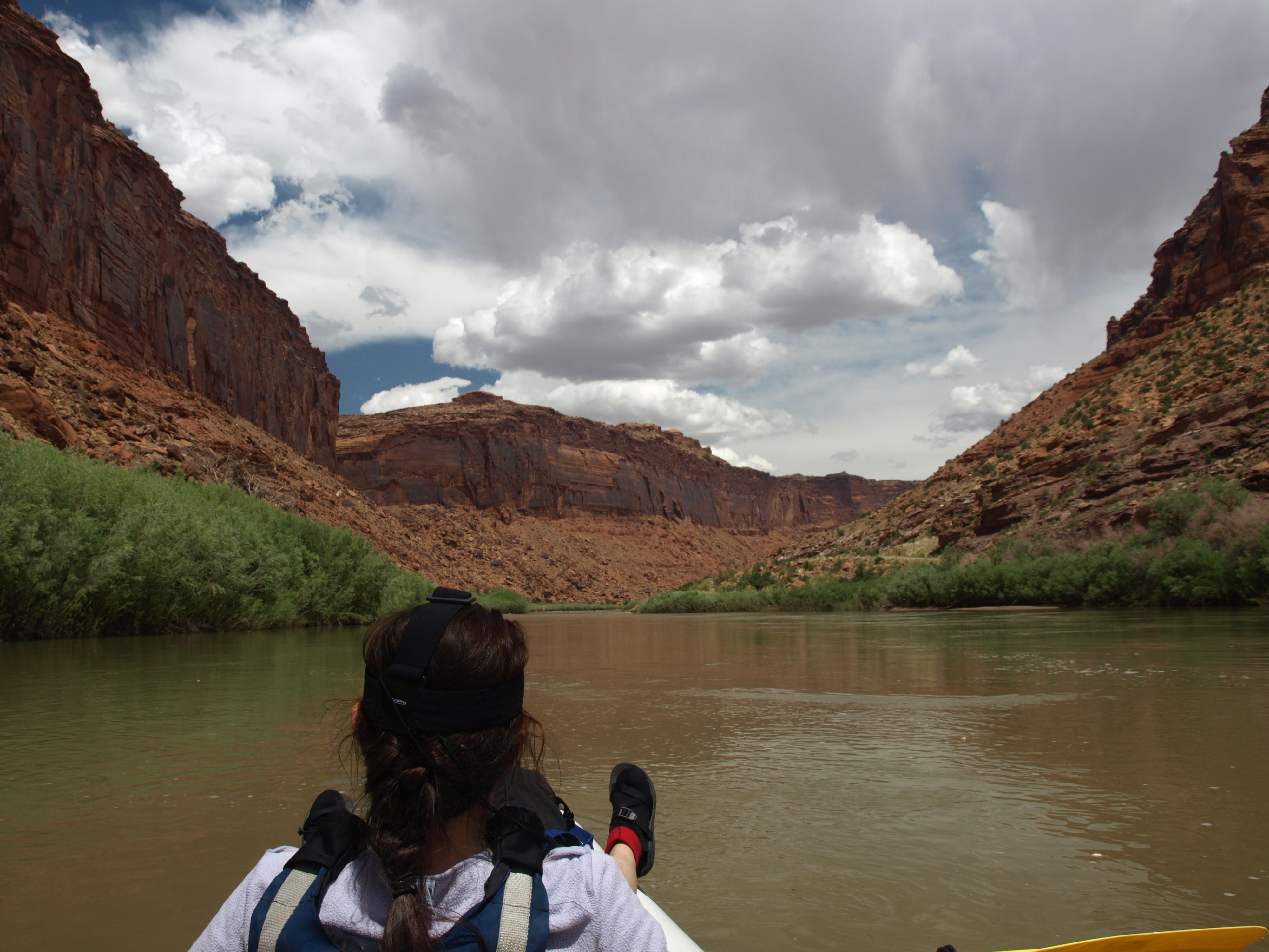
A lazy summer day on the river
Route
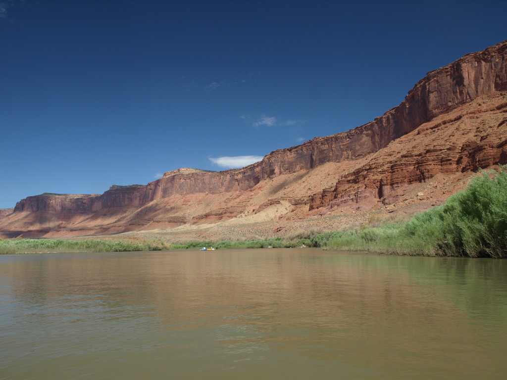
From Hittle Bottom, the river lazily floats along, as Fisher Towers comes into view in the distance on the left. Soon enough, where Onion Creek enters the Colorado, the first rapid is encountered. (Onion Creek Rapid) It is generally easiest on the left and quickly gives way to flat water.
Continuing down, Professor Creek's entry to the Colorado provides the next rapid. Again, it shortly gives way to flat water. In this section, Castleton Tower, the Convent, and Sister Superior become visible in the distance on the left. These towers loom over Castle Valley. Castleton Tower, in particular, stands proudly out on its own (the distinct tower on the far left in the distance). It is a destination and goal of many climbers. (The easiest route, the Kor route, goes at old school 5.8)
More flatwater leads to New Rapid followed fairly closely by Rocky Rapid. The section after Rocky Rapid is a good stretch to stop for lunch, with many good sites on the right to stop at.
Whites Rapid is next, where Castle Creek enters the river. It is likely the most difficult. Stay center or left to avoid a large hole on the right.
The trip is beginning to wind down at this point. A few more easy riffle sections and Salt Wash rapid mark the end of the trip. Just past Salt Wash rapid, Take Out Beach appears on the left. It is generally busy with guide companies getting clients and boats from the river. Be considerate and unload quickly if busy. There is a beach for landing, but also a ramp 30 m ( 99 ft. ) down river from the beach you can drive down to load your boat.
Photos
Maps


| Hittle Bottom |
12S 644362mE 4290763mN N38° 45' 14" W109° 20' 19" |
| Onion Creek Rapid |
12S 642466mE 4289000mN N38° 44' 18" W109° 21' 39" |
| Professor Creek Rapid |
12S 640799mE 4287151mN N38° 43' 19" W109° 22' 49" |
| New Rapid |
12S 639665mE 4285387mN N38° 42' 22" W109° 23' 37" |
| Rocky Rapid |
12S 638248mE 4284260mN N38° 41' 46" W109° 24' 37" |
| Whites Rapid |
12S 635029mE 4282763mN N38° 40' 59" W109° 26' 51" |
| Salt Wash Rapid |
12S 630515mE 4281200mN N38° 40' 11" W109° 29' 59" |
| Take Out Beach |
12S 630489mE 4280520mN N38° 39' 49" W109° 30' 01" |